

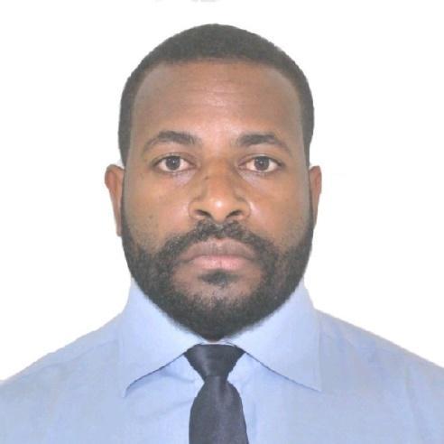
ADIAPE PORO
Perth
Summary
Organized and dependable candidate successful at managing multiple priorities with a positive attitude. Willingness to take on added responsibilities to meet team goals.
Professional in surveying field with strong expertise in topographic and underground mapping. Proven ability to ensure accurate data collection and analysis, contributing to efficient mining operations. Focused on team collaboration, adaptable to changing project needs, and committed to achieving precise results. Skilled in using modern surveying technology and software, and valued for reliability and effective communication.
Overview
11
11
years of professional experience
1
1
Certification
Work History
MINE SURVEYOR
Catalyst Metals Ltd.
Plutonic Gold Mine, Western Australia, Australia
02.2022 - Current
- End of Month survey process and reports
- Create setout files and prepare plans for all designs from Engineering and Geology
- Reduced safety hazards with diligent monitoring of mining activities and adherence to industry regulations.
- Do Check and sign off on designs
- Promoted a safe working environment by identifying potential hazards during routine inspections and recommending corrective actions as necessary.
- Timely Survey of Development Heading Markup and Pick-up of cuts
- Collaborated with engineers to optimize mine planning, resulting in increased mineral extraction rates.
- Development heading Laser installation and Memo creations for Jambo operators
- Maintained accurate records of all surveying activities, facilitating timely decision-making for mine operations.
- Production stope rings and laser offsets markup
- Evaluated potential new project sites by conducting thorough geological surveys and assessments.
- Airleg Stope Markup and Pickup
- Ensured compliance with regulatory requirements by maintaining up-to-date knowledge of relevant legislation and industry standards.
- Do calibration of Minnovare on all production drill rigs
- Assisted in the development of innovative survey techniques, advancing the overall capabilities of the team.
- CMS surveys of Stopes, RAR and Ore Pass
- Supported long-term mine planning strategies through comprehensive topographic mapping efforts.
- Markup and pickup of Geology Exploration and Mine Control diamond drill collars
- Improved mine survey accuracy by implementing advanced surveying technologies and methodologies.
- Processing the Pick-ups and updating Survey asbuilt
- Developed detailed 3D models of mining areas, aiding in future exploration efforts and production forecasts.
- Installation and Survey of new Survey controls and updating control database
- Guided field crews on proper survey methods and techniques.
- Creating Final Void models for EoMs volume calculations
- Coordinated surveys to establish accurate legal boundaries for properties.
- Creating Solids for development heading and advance meters for EOM reporting
- Followed local, regional and national surveying guidelines.
- Monthly calibration or check and adjust of TS16 Leica total stations
- Applied training and mathematical abilities to calculate heights, depths and relative positions of terrain.
- Cleaning and maintaining the care for all Surveying tools
- Attend start of shift meetings and maintain communication between teams about daily production priorities
- Keeping track of daily Surveying consumables and ordering them at the warehouse
- Open Pits Survey
- Markup and Pick-up of Drill patterns
- Markup of Ore blocks
- Ramp outline
- NO dig tape
- Daily surveys of shovel dig faces and append pit asbuilt
- Water level measurement
- UAV Survey of ROM, Tailings, Pit ETC
- Drone Data Processing in PIX4D
- Established standardized procedures for field measurements, ensuring consistent data quality across projects.
- Streamlined data collection processes for increased efficiency in mapping and reporting.
MINE SURVEYOR
Porgera Joint Venture
Porgera Gold Mine, Papua New Guinea
02.2019 - 06.2021
- Comply with all relevant policies and legislation
- Communicate daily with all UG/OP teams of operations priorities
- Executed Underground and Open Pit mine operations daily survey tasks as required
- Maintain and update survey control database
- Assist in End of Month measurements and reporting
- Check and control Surveys of main Underground stations
- Markup of Stope rig position and laser offset both downhole and uphole
- Markup and install laser for all development heading
- Append Pick-ups of cuts and process laser offsets Memo for jambo operators
- Markup of Raise bore drilling
- Markup of Exploration drilling
- Markup of infrastructure projects such as Vent door location, Paste holes, and Paste walls fans strips, sump, pump strip etc
- Down hole survey of Stope drill holes for QAQC
- Water level measurements
- Pickup of stock piles, waste dump, and daily shovel dig faces at Open Pit
- Drone Survey of the Stockpiles and crasher ore stock piles
- Processing and updating the Pit asbuilt
- Assist in EoM volume calculations and reporting
GRADUATE DEVELOPMENT PROGRAM MINE SURVEYOR
Porgera Joint Venture
Porgera Gold Mine, Papua New Guinea
02.2017 - 02.2019
- Completed learning objectives of Graduate Surveyor Development Program modules
- Assist the Surveyor in planning and coordinating of day to day Open Pit and Underground Mine Surveying
- Assist the Senior Surveyor in EoM reporting
- Pickup and Markup of production drill hole collars
- Markup of vertical drill holes for geo technical purposes
- Markup of Ramp and toe outline
- Markup of design toes or TBM's
- Pickup of daily infrastructure changes or update in pit
- Processing daily pickups and prepare plans or plots
- Drone surveys of quarry, dump, stockpile and airports
- Markup of grade line and profile of Development Heading
- Installations of Development Heading laser
- Markup of rig position and laser offset for drilling
- Exploration drills Markup and pickup
- Cleaning and maintaining all Survey tools
- Updating weekly Survey consumables and ordering if out of stocks
- Maintaining team work and good communication
- Maintaining safety standards
TRAINEE MINE SURVEYOR - VACATION EMPLOYMENT
Porgera Joint Venture
Porgera Gold Mine, Papua New Guinea
11.2015 - 03.2016
- Completed training requirements in OP mine Surveying
- Completed training requirements in Underground Mine Surveying
- Underground the roles and responsibilities of a mine Surveyor
- Exposure to latest Surveying equipment such as RTK Leica and Trimple GPS and Scanners
- Training reports compilation and presentation
TRAINEE MINE SURVEYOR - VACATION EMPLOYMENT
Porgera Joint Venture
Porgera Gold Mine, Papua New Guinea
10.2014 - 02.2015
- Exposure to Open Pit mining
- Experience in Open Pit daily mine Surveying tools and equipment
- Hands on experience in Leica and triple RTK GPS to do daily Surveying in Open Pit
- Hands on experience in scanners and processing data in Minesight software
- Pickup of drills holes and exporting as CSV files
- Hands on experience in Operating Leica TS16 and Renishaw Void Scanner in UG Mine
- Exposure to Underground Mining
- Markup and pickups of dailys
- Assist Surveyor in executing Underground daily surveys
- Markups and Pick-up
TRAINEE CONSTRUCTION SURVEYOR - VACATION EMPLOYMENT
Curtain Bros PNG Ltd
Tari, Papua New Guinea
11.2013 - 02.2014
- Operate Sokia Set5x total stations, SDR33 controller and hand held Magellan GPS
- Establishing control station and running traverse
- Topographic and road DYM pickup
- Downloading, editing and plotting in civil cad 2007 software
Education
Bachelor In Surveying - Surveying
Papua New Guinea University of Technology
Lae, Morobe Province02.2012
Lower & Upper Secondary School -
St Joseph's Tari Secondary School
Tari, Hela Province01.2007
Skills
- Continuous professional development
- Communication and presentation
- Task Prioritization
- Effective Communication
- Multitasking
- Time management abilities
- Problem-Solving
- Adaptability
- Survey equipment operation
- Total station operation
- Topographic surveys
- Detail orientation
- Documentation and reporting
- Prepare data
- Boundary surveys
- Team leadership
- Data entry
- GPS technology
- Geospatial data analysis
- Safety monitoring
- Drone surveying
- 3D laser scanning
- Software troubleshooting
- Drone surveying experience
- GPS and GNSS knowledge
- Vehicle operation
- Proficient in AutoCad
- Proficient in Microsoft Word, Power-point and Excel
Accomplishments
- Documented and resolved drone surveying data using DJI /LiDar image processing in Pix4D and CoPree which led to Plutonic Mine Survey standards
Certification
- Provide Advanced First Aid
- Work safely at heights, Trainwest, 02/01/23
- Remote Pilot Licence, Australia Civil Aviation Authority, 02/01/23
- RIIERR303E Operate in self-contained regenerative oxygen breathing apparatus
- Operate in Open Circuit Breathing Apparatus
Affiliations
- Association of Surveyors of Papua New Guinea, Member
- Western Australia Institution of Surveyors, Affiliate Member
- Australian Institute of Mine Surveyors
- Geospatial Council of Australia
Languages
English
Professional Working
Timeline
MINE SURVEYOR
Catalyst Metals Ltd.
02.2022 - Current
MINE SURVEYOR
Porgera Joint Venture
02.2019 - 06.2021
GRADUATE DEVELOPMENT PROGRAM MINE SURVEYOR
Porgera Joint Venture
02.2017 - 02.2019
TRAINEE MINE SURVEYOR - VACATION EMPLOYMENT
Porgera Joint Venture
11.2015 - 03.2016
TRAINEE MINE SURVEYOR - VACATION EMPLOYMENT
Porgera Joint Venture
10.2014 - 02.2015
TRAINEE CONSTRUCTION SURVEYOR - VACATION EMPLOYMENT
Curtain Bros PNG Ltd
11.2013 - 02.2014
Lower & Upper Secondary School -
St Joseph's Tari Secondary School
Bachelor In Surveying - Surveying
Papua New Guinea University of Technology